Hurricane Isabel Damage along the Outer Banks, NC
by Will Cook
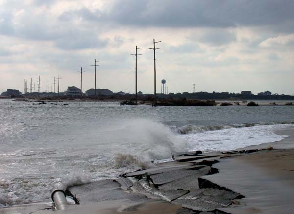
| On September 18, 2003 Hurricane Isabel slammed into the Outer Banks of North Carolina, causing extensive damage and creating this new inlet on Hatteras Island between the villages of Hatteras (ahead) and Frisco. Here the road is crumbling into the inlet. Note the double yellow line - definitely a no passing zone! These photos were taken on October 18, 2003, exactly one month after the hurricane. |
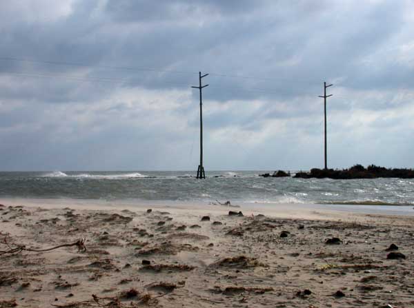
| The new inlet, or breach, as the Army Corps of Engineers calls it, was up to 24 feet deep, about 1700 feet wide, and divided into three channels. The Army Corps started filling the breach with dredge spoil on October 17 and completed the job on November 4. The inlet is no more. The road was repaved and opened to the public on November 18, exactly two months after the hurricane hit. |
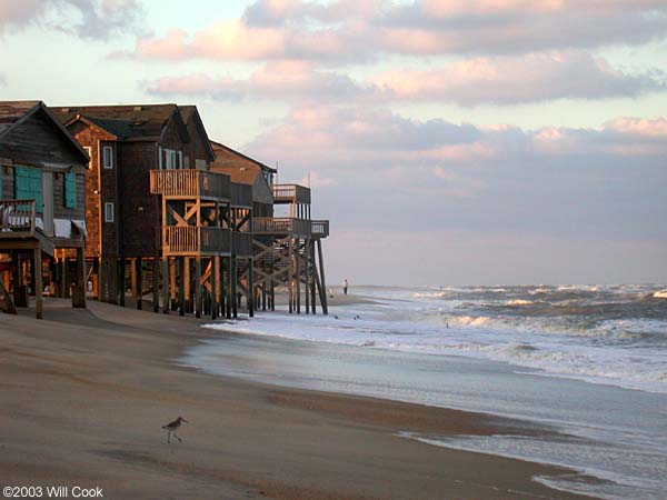
| Further up the Banks, near the Chicamacomico Lifesaving Station in Rodanthe, a number of houses appear to be marching into the sea, as a Willet looks on. |
| Lone sentinel in the sunset. |
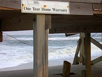
| I suspect this home warranty is no longer in effect. |
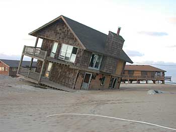
| Full tilt. |
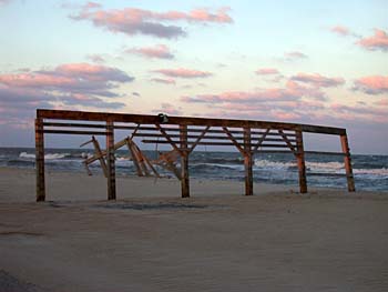
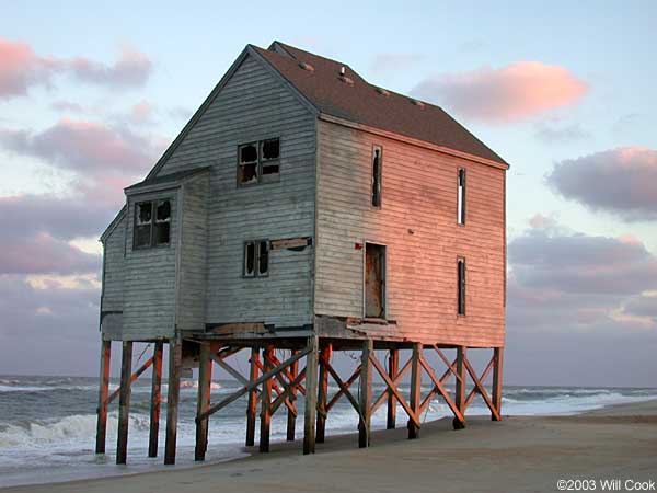
| House no more, well on its way to becoming one with the sea. |
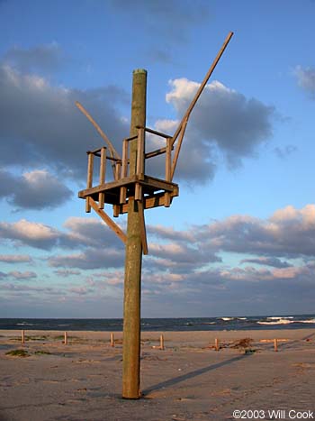
| What's this bizarre object sticking out of the sand? Scott Gibson wrote to tell me that this is a stand-in for a ship's mast, used by the Chicamacomico Lifesaving Station to re-enact surf drills common during the days of the lifesaving service. Still, it makes me think of a ruined windmill... |
| Don Quixote would be proud of the efforts of real estate developers to build next to the ocean on the shifting sands of the Outer Banks. This fancy new beach house "Sundance", just opened in 2003, is adjacent to the "windmill" and beach houses fending off the waves above. Fourteen trip leaders stayed here during the 2003 Wings Over Water birding festival. It's quite nice, but how long will it last? |